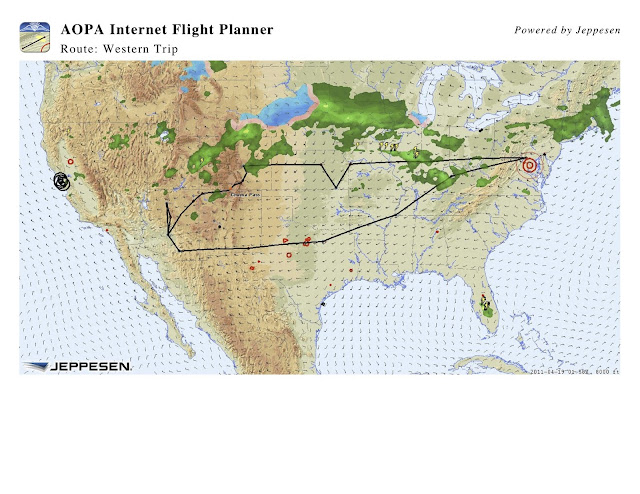
Planning for our trip to our niece's wedding in Phoenix is coming along. The approximate route is shown below, taken from the AOPA Flight Planner. Hopefully those storms will clear up before we arrive ;-).
The outbound route takes us to Independence MO, Independence KS, Abilene KS, Colorado Springs CO, and finally two legs through the mountains to Phoenix AZ. After the wedding we'll fly to see the Grand Canyon and Sedona AZ before returning to Phoenix one last time. The return trip goes to Tucson AZ, Carlsbad NM, Dallas TX, Memphis TN and one final stop to get home. 15 legs in all (so far).
The plane is a 1984 Cessna R182, tail # N6321T, which finished an annual inspection last month with Frederick Flight Center (FFC). Its part of a 4-man partnership. We have a conventional panel with a Garmin 430 (WAAS). We just upgraded the tablet which provides XM weather in the cockpit to a Control Vision Duo for a very reasonable price. A solid state drive means we can go above 10,000 ft without shutting it down (interesting story there about how conventional hard drive heads "fly" over the disk surface aerodynamically). That will likely be pretty useful for this trip when we pick our way through the Rockies.
We also got a four place Aeromedix Oxygen system for the mountain flying. I've heard a lot on both sides of the O2 question, but it seemed like a fairly small investment to give us some additional room to maneuver. The plane will go to 18,000 ft, but the FAA says a pilot needs to start thinking about O2 at 12.5K, and pax need help when they need help, but O2 must be provided at 15K. I haven't figured what it would cost in gas and flying hours to fly from the Springs south to I40 and then to Phoenix if weather forced us out of the taller mountains. We may actually end up going that way if weather is too bad. Still, it would only take avoiding just one major deviation like that to start paying off the O2, so I can't see this as a bad decision.
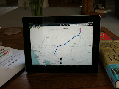
I've converted to electronic maps and charts with a new iPad 2, the Foreflight app, and a $75 / yr chart subscription. So far this has been great. I tested the iPad in the DA40 managed by FFC a week back,
flying approaches to both Gettysburg PA and Frederick MD. Foreflight makes it easy to get to airports and their charts. Just bring up a map, touch the airport, select approaches and there you are. I found it sat nicely on the left leg without any special holder or straps, but there was only light turbulence on that flight. The partnership is talking about putting a Baron wifi in 21T when it comes out. This will make it possible to take the XM weather signal we already have and put it on an iPad so both the tablet and iPad will have current weather available on different screens and formats. Not sure if this particular setup will offer an internet connection as well, but we'll see.
It took quite a while to make all the travel arrangements. Hotels are pretty easy. We made reservations early for anyplace that looked like it might be in demand (Grand Canyon and Sedona), and deferred to local airport advertising where they frequently have pilot discounts for most others. Memphis presented a peculiar problem with the Mississippi rising in the area. We're praying for folks at Gen Dewitt Spain airport located right by the river north of Memphis who suggested waiting to make plans.
Rental cars are more problematic, especially when arriving on a weekend in some locations. Enterprise is listed at a lot of locations, and is frequently the only choice at smaller airports. Our experience with them has been "spotty" on multiple trips to Grosse Ile MI south of Detroit. Still, ever hopeful. Smaller fields away from big cities tend to be much friendlier and helpful.
Where we are not just going to visit with friends, Ann has been getting information on places to see. More on that as the trip unfolds.


No comments:
Post a Comment
What do you think?