Monday, May 23 is a windy day. I've been figuring fuel burn and take off performance for a few days now -- even went out to the airport to measure how much fuel remained in the tanks.
(For those pilots and non-pilots among you who are not interested in some of the details of flight planning in the mountains, roll on down to the pretty pictures ;-).
The reason this is important is density altitude. Mike Lackey mentioned how every summer someone busts up a perfectly good airplane because they're overloaded and it just won't get off the ground at high altitude, high temperature, and high humidity. The airplane thinks its at 10,000 ft where climb performance stinks, vice the actual runway altitude. Mike mentioned this maybe a half dozen times, and the mountain flying books I studied said much the same thing. Even those of us in the slow learner's group picked up on the theme.
I got out the owners manual and found that at 2800 lbs we would be good up to around 100 degrees at Grand Canyon airport which has a long 8999 ft runway at 6609 ft altitude, and also good at Sedona with a shorter 5132 ft runway but at 4830 ft altitude. All I needed to do was make sure we came in at or below 2800 lbs. That meant leaving fuel at 6 lbs / gal on the ground. Turned out adding 23 gallons a side gave us enough fuel for the entire loop back to Chandler. Interesting exercise, though, and the first time I had actually had to put this little bit of flight planning to use.
So we're loaded early and off to Grand Canyon. The terrain gets pretty high on this leg, so we file and go at 12000 ft, following airways. Oxygen is not mandatory at this altitude, but we hook it up and keep everyone happy along the way.
Eventually we get close to Grand Canyon airport and are handed off from Albequerque Center to Los Angeles Center when I cancel IFR and start manuevering to the Grand Canyon SFRA GA corridors. There are four of these corridors, from west to east: Tuckup, Fossil Canyon, Dragon and Zuni Point. We're going to use Zuni northbound, and Dragon south back to the airport. This takes a little planning as well. I did not input GPS coordinates, preferring to use VOR fixes for each end of each corridor. The SFRA map for the area has all this info and more for both commercial operators who get to fly lower, and we pleasure operators.
And thar she blows . . .
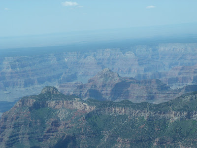
We're discovering what really good photographers probably already know about how the light and haze mix. Also, although the Panasonic has a very good system, when you put the telephoto out it strains the stabilization functions. This is especially true if the air is choppy.
Even with all the problems of getting good pics, the views are magnificent, and every once in a while a blind squirrel finds an acorn.
We land, do the bag drag to the Maswik Lodge, join some of the other guests walking to their rooms,
grab a little lunch, and finally get out to do some serious sight seeing, which is even more spectacular for not being in motion.
While spectacular from the air, it feels different on the ground. I'd guess this is mainly due to the surface limiting the range of view. From the air, even though the Canyon is immense, you can see the land all around all the way to the horizon. I think this lowers the sense of scale.
It's not particularly crowded, mainly because school is not out yet. Still, there are folks from all over
and we stop to chat with friendly local couple.
The four of us start working our way along the southern Rim Path, first to the west to see the first photographic studios constructed on the rim in the early 1900s,
and then back to the east where the Rim Trail leads eventually to Mather Point and beyond.
Eventually, the kids get tired of walking and start doing whatever kids do
so Ann and I trek off on our own to Mather Point.
The point of Mather Point is obscure. Yes, the kids are Mathers, and Ann's maiden name is Mather, but apparently they are not related to this particular Mather. They are all of the Cotton Mather line, not the Steven Mather of Grand Canyon line. Nonetheless, this has become a "point" of honor, so off we go.
On the latter two pics you can see the other trail, the one that goes all the way down (and all the way up). We enjoyed seeing it from this perspective ;-), although the Canyon troops take pains to note just how far you've walked even on relatively level terrain.
Eventually we make it to Mather Point which offers the requisite phenomenal views along the way, and also a short trek to a park bus heading back to our rooms. Park buses are great. They run to all areas of the park so you really don't need to take a car, though you do need to figure out their routes.
One thing you can say for the Grand Canyon is they have a full range of restaurants. After traveling and hiking all day we were all looking forward to relaxing with a drink and a good steak.
Ann and I went back to change, but the kids had been busy that afternoon. Seems to get into the El Tovar Restaurant, one needs to make reservations months in advance. We had actually checked a few days before, but apparently lacked the necessary ambiance to move mountains. Jim, on the other hand, worked some magic with the Mather name and all was well for a 7:45 reservation.
Kids.


No comments:
Post a Comment
What do you think?